Interactive Oil Spill Map
Building an effective dialogue for a successful partnership
Community engagement should be carried out during the preparation stages of oil spill response plans, during any active spill, and after dealing with the spill to keep the community informed about plans to mitigate any health, economic, and environmental potential long term impact of the spill.
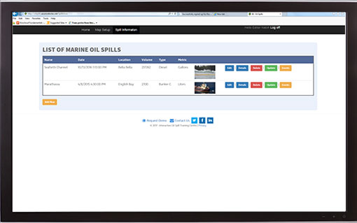
- Spill Information including images and videos
- Safety and emergency information
- Instant updates to keep the community informed
- Email updates to subscribers
- Social media communication
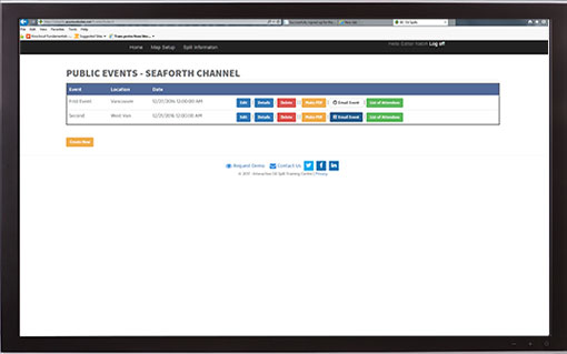
- Public events and registration
- Volunteers registration
iSpillMap
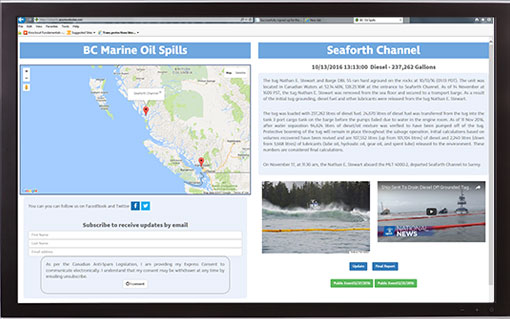
iSpillMap is an interactive community engagement communication and information cloud based tool designed by marine scientists with many year of experience in the field of oil spill response and training.
Transparency and timely information dissemination when oil spills occur, during response activities, and after the spill, is very important to sustain the trust between the community, response organizations, and government agencies.
Accurate up-to-date reports is provided through the incident command centre minimizing the unreliable information disseminated through traditional media or social media. This transparency would alleviate friction between the community and government agencies.
IOSTC has developed an easy to use cloud based application allowing for updates to be made without the need for web designers or information technology specialists. Based on Google maps, the person in charge of public affairs enters the spill information and daily updates, including images and videos, through user friendly screens. The program also allows interested members of the community to subscribe to receive regular updates by email, and to interact with the response team through social media (Facebook and Twitter).
iSpillMap is a customizable program, it can be installed on your server or hosted and maintained by our team.
Easy to use
- Post and edit spill information including videos and images.
- Post and edit regular response activities updates and generate PDF documents for circulation and sending by email to subscribers.
- Post and edit public events information, generate PDF documents for circulations and sending by email to registered individuals.
- Volunteers registration and on-line approval, automated registration form, and provide access code for on-line spill response courses and knowledge testing.
- Modify the map viewpoint.